Thursday, October 29, 2009

Fake America

Acadia National Park to Winchester VA (10/24-10/29):

When we woke in the morning, rain was thundering on our tent, and we stayed for a bit wrapped in our warm sleeping bags and blankets. We finally got out and discovered that it sounded worse than it actually was. A few minutes later a ranger came up and asked us to leave as soon as possible because they were closing the campground due to a storm with high winds that was coming in. We drove south through lots of rain that made it hard to see too far in front of us, but we were unscathed.

We spent the next few days in the major cities along the eastern seaboard (aka fake America) visiting friends. The highlights came from catching up and having fun with friends, which I will therefore not talk about here except to say how nice it was and to thank everyone for hosting us.

We made some nerdy history trips to Valley Forge and Harper's Ferry and a trip to Pennsylvania Dutch Country. At Valley Forge, we were regaled with Revolutionary War tales by a slightly idiot savant-type park ranger. Interesting Valley Forge facts: VF was actually not the coldest or most difficult winter that the Continental Army faced during the war, but it is considered to be the founding of the US army because it's where the troops got training from European advisers. PA Dutch country was what you would figure: really touristy with some Amish driving around in buggies who probably didn't want us gawking at them. So it was a little awkward, but we had some great food at a family-style restaurant where we were luckily the only people since they normally enforce conversation between dining parties.

Harper's Ferry is a nice little town just inside West Virginia. I've only heard of it in conjunction with the John Brown raid, but it played an important part in industrial America and in the Civil War. It's a beautiful little town sandwiched in between some mountain-y hills on a river. It's also on the Appalachian Trail, which allowed me to revive my secret dream of one day hiking the entire AT.
-M


The Far East

Portland, Maine to Acadia National Park (10/23):

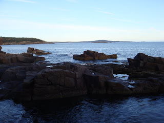
This is the first visit that either of us has made to New England, and I’m pleasantly surprised by the New England-y-ness of it all. We passed through lots of beautiful quaint towns with lots of Main Streets on our way to Acadia National Park. For once we actually arrived at a campsite during the day and set up our campsite in the light. We then drove around the park, seeing the Atlantic Ocean for the first time on the road trip. We drove to the top of Cadillac Mountain which, though it is the tallest mountain on the Atlantic Coast, is quite short but still affords good views of the ocean and surrounding Maine-y scenery. We had dinner in neighboring Bar Harbor, a town that was clearly a day or two away from shutting down for the season and had lots of deals on lewd sweatshirts, which we did not take advantage of. After dinner, we went back to camp, where I dressed in every layer I had with me (four thermal shirts, hoodie, fleece jacket, sweatshirt, leggings, three pairs of yoga/sweat pants and my winter coat). Though it was nearly impossible to bend my elbows or move, thanks to the layers and Brad’s fire, we passed the evening warmly.

This is the furthest east we'll be on our trip!
-M


Autumn Sweater

Seneca State Park NY to Portland Maine (10/22):

Today was our autumnal leaves day, though we’ve been seeing beautiful leaves for the past week or two. But the leaves in New England were full of vibrant color that seemed to pop. We stopped in Bennington, VT for some lunch (local, organic, and sustainable, natch) before visiting Robert Frost’s grave and a Revolutionary War monument obelisk that gives a view of the Green Mountains and surrounding area. The highways here were smaller and more crowded that the ones we’ve been on outside of the East Coast, but they wound through lots of leafy scenery. We arrived in Portland after dark and spent the night in a hotel and watched political ads for and against the upcoming gay marriage vote.
-M


Thursday, October 22, 2009

Oh Canada!

Cleveland, OH to Seneca Falls, NY via Niagara Falls (10/21):

After a great visit with family, we set off from Cleveland for our adopted home state of NY and went to Niagara Falls, NY. We'd heard from a lot of people that the view from Canada was much better, but I was concerned that I'd have to report foreign travel for my security clearance, which could potentially slow down what has already been a 5 month investigation. But the State Department's security clearance customer service center said it wasn't a problem since I'd only be there a couple hours, and I didn't even need to report it. After a tense search throughout the car for our passports, we walked across the Rainbow Bridge to Canada. Though Lonely Planet dutifully informed us that Niagara Falls are neither the biggest nor the greatest in the world, they were really incredible. I'd kind of always chalked up Niagara Falls as a cheesy tourist experience, but they were phenomenal, and the fall leaves made the views all the better. We walked back to the US after an hour or two. This is probably the only time that arriving on American soil hasn't made me weepy and sentimental given that it was only an hour or so.

We drove further into NY state, setting up camp in a state park near Seneca Falls, NY on the banks of one of the finger lakes. We set up in the dark, which was less than ideal, but most everything else was perfect. It was a nice campsite with other people around, and the weather was pleasant. It's been awhile since we've seen another tent camper (everyone else has been in RVs), but that might change when we head south in a week or so.

While in Canada, we took some idyllic pictures, as well as some that look like we photoshopped ourselves in.

-M


Cleveland Rocks!

Escanaba MI to Cleveland via Detroit (10/19-10/20):

After an early start from Escanaba, we broke up our long drive to Cleveland with a brief stop in Detroit. We saw the graveyard of a ruined carmaker and then had lunch in Greektown, where a waiter set our cheese on fire and screamed "Opa!!" at the top of his lungs, much to our astonishment. I was surprised at the number of Arab waiters in a Greek restaurant until I remembered that Detroit and the surrounding area is a major Arab center in the U.S. We were also a bit surprised to find Canada so close to Detroit, just over the river.

We then spent some time in Cleveland with a lovely visit to Brad's mom and stepfather. In addition to a heated game of Scategories, we took in some beautiful fall foliage on a bike ride through Cuyahoga National Park and spent some time with our bunnies.
-M


Sunday, October 18, 2009

Duluth!

Duluth MN to Escanaba, MI (10/18):

We spent the morning walking around the shore of Lake Superior by Duluth's harbor. We then watched the Browns/Steelers game, which made Brad sad. This was followed by a long drive through Wisconsin and Michigan's upper peninsula on Highway 2. It was largely forest, punctuated by small towns, similar to what we've seen in the MN North Country.

-M


Highway 61 Visited

Schoolcraft SP to Duluth via Voyageurs National Park (10/17):

We headed into Hibbing in the morning, swinging by Dylan's old house (whose current occupants are Franken supporters! -M) and driving around the neighborhood a bit. Then up to Voyageurs National Park, on the Canadian border, where it is clearly the off season. The main activity there is boating, though, there is none to be had if you don't have your own boat, so we hiked to a lake and that was that. We drove south to Duluth on Highway 61, while listening to Highway 61, saw a lighthouse, and ate in downtown Duluth, which is one of the nicer towns we've seen.
-B

Today, within about 12 hours, Brad and I camped, toured the sights of Hibbing, visited a national park, hiked, drove a couple hundred miles, and hung around Duluth, which raises the question of what the hell we spend our time doing when we're not traveling.

-M


Traveling to the North Country

Bismarck to Schoolcraft State Park, MN (10/16):

We drove through Fargo and into Minnesota to begin the Dylan portion of the road trip. We ended up stopping a bit short of Hibbing at a state park, then drove in to nearby Grand Rapids for some mexican and a late showing of the Informant. We were the only ones camping in the park, which we determined by driving around the campsite several times when we got back from the movie because it was midnight and we couldn't find where we'd put the tent. It is getting a bit cold at night now, but we've only got another week or so north of the mason dixon.
-B

This was the most isolated campground we've stayed at--a state park miles from anything that looked like no one had been around in weeks. I could have wept driving around Grand Rapids (birthplace of Judy Garland btw) looking at all those familiar garish neon strip mall and motel signs and thinking of our lonely tent in the icy forest. But we're troopers and soldiered on, albeit with an implicit understanding that we'd trade the tent for a motel a bit more in the coming week or so while it's so cold and desolate.

Also, Paul Bunyan is apparently a Minnesota thing, and we saw lots of PB statues and references, and I stood in the hand of this creepy statue.
-M

Thursday, October 15, 2009

The Badlands of North Dakota

Ellendale, ND to Bismarck via Teddy Roosevelt (10/15):

The roads were mostly clear when we woke up, save for the occasional dead pheasant in the parking lot that had fallen out of a hunter's truck. We headed west through North Dakota, noting that like Southern drivers, North Dakotans like to drive in the left passing lane so it's impossible to get by the slow drivers. North Dakota is mostly flat with some rolling hills, at least along the interstate where we were, until the western edge where it suddenly develops into badlands like those of South Dakota. The southern section of Teddy Roosevelt National Park, our destination, is made up of these. We only had a couple hours of time before we needed to leave, so we settled for a visit to Teddy Roosevelt's former cabin, a scenic drive and a small walk/hike along a ridge with some scenic overlooks of a river and hills. I don't like being those people who go to national parks and then drive around without leaving their car, but at least we got out for a little bit. Teddy Roosevelt is known for having lots of wildlife, and we saw a bunch of deer, bison, a herd of elk, prairie dogs and wild horses. The highway monotony was broken up with a visit to Salem Sue, the world's largest Holstein cow.

We're noticing a dramatic decrease in the number of people around at all these tourist sites as we get further into fall. After the cold and snow of the past few days, we've realized it's probably a good idea to speed through the northern parts of the trip as fast as possible so we can head to warmer weather.

-M


Reading Lolita in Iowa

Clear Lake to Ellendale, ND (10/14):

A huge day of driving awaited us today after waking up to a slushy and rainy morning, though the driving was broken up by listening to an audiobook of Lolita read by Jeremy Irons, who happily sounds a bit like Sideshow Bob from the Simpsons. In South Dakota, we took a great detour to the Corn Palace in Mitchell, SD. This city has built a civic center with giant domes, decorated it with murals fashioned out of corn, and then put billboards up all over the highway letting people know of this feat. You have to respect a small town for coming up with creative ways to drum up tourism. We planned many more hours of driving post-Corn Palace, but after a couple hours the persistent rain turned into a light snow which then turned into scary snow in the early evening. As southerners who’ve lived car-less for the last 5 years, we don’t have much snow-driving experience and after I freaked out about the slushing and skidding, we stopped at the first opportunity, which was Ellendale, North Dakota. Our motel is connected to a restaurant/bar, so we had a few enjoyable beers with other motel patrons, mostly hunters from Minnesota, who didn’t entirely understand why we would be in North Dakota if we didn’t hunt.
-M


Drove our Chevy to the campsite, but the campsite was snowy and cold

Chicago to Clear Lake, Iowa via Madison (10/13):

Chicago thus accomplished, we headed north to Madison, Wisconsin, where we saw the largest capital outside of Washington DC. We then went to Iowa, where we passed through Dubuque on the border, which is just about the most charming-looking town you could find anywhere. We stopped in Clear Lake in the middle of the state, for one of the most unpleasant nights of camping—really cold, with rain turning to snow and then back to rain throughout the night. Although we didn’t realize it until the next day, Clear Lake is the site where the plane of Buddy Holly and the Big Bopper crashed. Nothing in the town is open past 7:30, so our search for firewood was futile, and we spent the evening hanging out in the car to stay warm until bedtime.
-M

Heading West, Via Chicago

Mounds State Park to Chicago (10/12):

Our tour of the Midwest begins in earnest with a stop in Chicago. Mandy hooked us up with a walking tour that included such sites as the start of Route 66, stolen bricks chipped off the pyramids, and a giant reflective bean. Chicago seems to be under the misapprehension that the city with the most sculptures wins, and it is determined to make a go of it. We had pizza for lunch, when in Rome, entering the restaurant to Secrets of the Sea and leaving it to Box Full of Letters. Chicago! It made us fairly ill, so we watched three hours of project runway at the hotel and then went to a wine bar at night.

-B


Living on the road, my friend...

Knoxville to Mounds State Park, IN (10/11):

Loop 2 begins today, with the plan on the outset to make a triangle from North Dakota to Maine to Florida, hitting all relevant points in between. We start with a drive north to Indiana and stop in Lexington to watch the Browns game, where happily, the spark provided by both of Derek Anderson’s completions was enough to push them over the Bills. The Browns’ win, coupled with losses by Tennessee and the Jets, means two things: a, we are likely the best 1-4 team in the league right now, and b, Braylon Edwards quite possibly has the longest losing streak of any active NFL player. The win accomplished, we went on into Indiana and stayed at one of the nicer state parks we’ve seen, and somehow we made a fire so strong that it seemed to mockingly thrive on the water we poured on it when it was time to go to bed.
-B

Thursday, October 8, 2009

Northwest Loop: The Stats

As we plan our next route through the USA, here are some stats from the Northwest segment of what is promising to be an epic journey.

Mileage: 10,276 miles
Number of states: 21
Number of national parks: 15

We've uploaded some picture highlights from the past month in the right sidebar. If flipping through lots of other people's vacation photos isn't really your thing, but you'd still like to get an idea of what we saw, I've also made a Highlights album that has some of the best photos from the other albums.
-M

Viva Knoxvegas

Cedar Bluff, Kansas to Eddyville, Kentucky (10/7)
Eddyville, Kentucky to Knoxville (10/8):

So the rest of the trip back to Knoxville was pretty boring, encompassing 12 hours of driving the first day and 6 the second. The only notable stop was in St. Louis on the first day, where we had some famous ice cream custard that we'd missed the first go-around. After several failed attempts at finding campsites Wednesday night, we found a hotel somewhere in Kentucky and made it back to Knoxville the next day to unpack, regroup and do lots and lots of laundry.
-M

Rocky Mountain High

Rocky Mountain National Park to Cedar Bluff, Kansas (10/6):

Today was a battle against the elements. The overnight temperature was much colder than anything we'd faced as of yet (teens), and it was accompanied by a strong wind which our tent didn't entirely block out. For the record, I was wearing two pairs of socks, three pairs of pants, three shirts, a fleece jacket, and my winter coat and was covered by my sleeping bag and three blankets, but I still woke up around dawn really freaking cold. Dawn is also when the elks began their mating bugles again, this time about a hundred yards from our tent. From a closer distance, it sounds less like a bugle and more like an old-school modem screeching while making a connection. But we were listening to an elk hanging out in front of our tent, which was pretty damn cool, so all is forgiven.

We then headed over to Bear Lake for our 3 and 6/10 mile hike. The elevation increase was 605 feet from the trailhead, which is similar to hikes we've done at Lassen, Crater Lake, and Glacier, but it started from 9475 feet, climbing to over 10,000 at the end. I rarely stop when we're hiking, but given that anything over 7,500 feet makes me out of breath and dizzy, making it up that climb was really intense. Close to the top I had to stop and flop out on a boulder for a minute to catch my breath, and by the top my head was swirling and I was pretty dizzy. Added to that was a crazy wind with strong gusts that sometimes blew shards of ice into our face at 25 mph. The trail was covered with ice and snow, which made for a slick journey back down the mountain. That does make it sound much worse than it actually was, as I did enjoy myself as we were hiking, but perhaps a bit less than I normally enjoy hiking. Even more enjoyable than the hike was thinking about the hike in retrospect, and we treated ourselves to a giant lunch at Cracker Barrel in the afternoon.


Rocky Mountain NP was our last stop of this leg of the road trip, so the next two days will involve driving as far as we can without many fun stops. After leaving the park, we made it to western Kansas by 10 pm, finding a state park to throw up our tent for the night. I was a little wary of the park because it was dark and scary with no one around, but it was a close to full moon and because it was Kansas it was flat with few trees, so I reasoned we'd be able to see someone coming from pretty far away.
-M

This is what it sounds like when elks cry

Salt Lake City to Rocky Mountain National Park (10/5):

We woke to clear skies in Salt Lake and got to see for the first time the mountains that surround the city. Those suckers are huge! We crossed through the mountains in a semi-blizzard, stopping in Park City for breakfast where we saw from afar the ski jumps from the 2002 Olympics. We drove a LONG time through the non-varying landscape of Wyoming before making it to Rocky Mountain National Park after dark. It is currently elk mating season, and our campsite is in the middle of the prime area for this, so we heard a lot of elk "bugling" as it is called, which sounds kind of like a warbling moan if moans were high-pitched. It's a nice sound, though probably will not make it to any white noise machines anytime soon. The campsite is at 8,500 feet, and as mentioned before, I've discovered that I start feeling the effects of altitude at embarrassingly low levels (like 7500 feet), so I'm a bit out of breath.

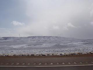
This is what our drive looked like for several hours until it just became several hours of yellow/green fields (notice the wind turbines!):


-M

Sunday, October 4, 2009

Salt Lake City

Great Basin NP to Salt Lake City (10/4):

The wind continued to howl during the night, and we woke up a couple of times to giant gusts that seemed to threaten to uproot the tent. We woke up in the morning to the sounds of rain, and stayed curled up in our warm sleeping bags and blankets until it stopped. We left the tent to find out that the reason it wasn’t raining anymore was because it was snowing heavily. Packing up the car was slowed both by the wind and snow. After we un-staked the tent and were putting stuff in the car, we turned around to see our tent sailing off into the forest. I was also of little help, as I’m apparently really sensitive to high altitude. The camp is at about 7,500 feet and I’d noticed being short of breath the night before. In the morning, I couldn’t take more than a few steps without getting really out of breath and then getting really light-headed from not being able to breathe. So between my feebleness and the raging snow, we nixed the idea of a hike or scenic drive even further up the mountain, and satisfied ourselves with a trip to the visitor’s center where we looked at pictures of what we could have seen.

The snow stopped as soon as we left the park, and much of the driving scenery was similar to yesterday. We got to Salt Lake City to find a chilly rain. We were pretty tired from all the driving and not really in the mood to wander around wet and cold, so we didn't do much besides a quick drive around the city center. We'll probably do a bit more exploring in the morning, but a couple observations about SLC: 1) the streets are incredibly wide, and according to Lonely Planet, this is because they were designed so that a full team of 4 oxen could turn a cart around in the road. Because the streets are so big, in some places you can cross in special crosswalks mid-street, which come equipped with little orange flags that you can carry across to make yourself more noticeable.

2) There are a lot of breast augmentation ads around, including billboards, commercials, and Facebook ads from my Utah-based IP address.

3) There were several people just a *bit* too naked at the local Walmart, even allowing for it being Walmart.


-M
P.S. Happy 10-4 day!!

The Great American Road Trip

Yosemite to Great Basin National Park (10/3):

We devoted our Yosemite time today to exploring the valley. Yosemite is PACKED with people, even though it’s the off-season, and the Valley is the most popular place to be in the park. The majority of the visitors—or at least a substantial percentage—seem to be foreign, and I heard a ranger say that was typical for the fall months. We put our car in day-use parking, and we rented bikes to tour the valley that way. The other national parks we’ve been in are pretty ambivalent about biking—they allow it, but only on park roads which are normally winding and narrow and teeming with giant RVs. Yosemite, though, has actual bike paths throughout the valley that allow you to get around without contending with any cars at all. It only took us a little over an hour to make a circle, by which point we were ready to move on. The bikes were decades old and pretty painful and made going up the tiniest hill a major struggle. But it was definitely the best way to get around, and it was pleasant riding around all the rocks, forests, and meadows. We decided to forgo a hike since we biked, and set off east out of the park.


We planned to drive about halfway across Nevada and camp at a sight midway across. Brad and I are both enchanted by the drive across the Great Basin. It’s desolate, with desert-y shrubs stretching out for miles, interrupted every so often by small mountain ranges. There are towns every couple hundred miles, with literally nothing in between. This is what you think of when you think of a cross-country road trip, and it's especially fitting set to the soundtrack of Tom Petty’s Highway Companion. A good portion of the highway skirts the northern border of a massive military site, which our atlas says contains Yucca Mountain, a test range and a test site. Lonely Planet fills in some other details, such as the fact that Area 51 is located here.

Our drive was much faster than expected though, so we decided to skip the first site and go to the next. We pulled up after dark to find it completely deserted, but open. I was a little freaked out by the desolation, but we were starting to think about staying when we saw a tiny notice posted that the campground was closed. Decision made, we left the murder campground (as Brad began referring to it). It was only another hour or so to Great Basin National Park, near the Utah border, which was our destination for the next morning, so we took a chance that campgrounds would be open and headed in. We found a campsite and set up our tent in the howling wind and went to bed.
-M

A bed of california stars

Red Bluff, CA to Yosemite NP (10/2):

Our days for the rest of this loop of the road trip until we get back to Knoxville will be fairly driving-heavy, but we still have some good detours to make. Today’s long drive took us through central California and Sacramento (or Sacramendy as Maeby Funke would have it) until we reached Yosemite. The land is really flat with mountains you can barely make out in the far distance. Minus these mountains, it actually looks a lot like Kansas or Nebraska, with lots of corn, farm machinery, and grain elevators. We got to Yosemite late in the afternoon and were lucky enough to get a campsite even though we hadn’t made reservations.

I didn’t really know what to expect from Yosemite or even what it was famous for. In fact, until we went to Yellowstone, I always confused the two parks. But Yosemite is famous for rocks and waterfalls. The most famous sites are clustered in Yosemite Valley, which also has a lot of the campgrounds and lodging. All those campsites were full when we got there, so we had a campsite near Glacier Point, about 30-45 minutes away from the Valley. Up the road from our campsite was an overlook of the valley, and we headed up there (along with a few hundred other people) to watch the sunset.

Yosemite is a bear-y park, so it’s the first time that’s been a factor in the last week or so. In terms of food storage, Yosemite is much stricter than the other parks we’ve been in. Everywhere else, you have to be really careful not to leave out any food that isn’t in immediate use, but as long as you leave it in your car with the windows rolled up, you’re fine. The bears are a bit cleverer at Yosemite, though, (smarter than your average one -B) and they have learned that they can actually rip the doors and trunks off cars to get to the food that they can smell inside. Therefore, everything with a scent (and that includes all food and toiletries) have to be locked in special bear boxes that are located at each campsite. The bears can still smell everything in there, but they have learned that they can’t get in, so they don’t bother (at least in theory). Bears on hikes don’t seem to be an issue though—I never even read or heard any suggestion of bringing bear spray along.

Not wanting to tempt the bear fates, we decided to eat in the valley so we wouldn’t have to deal with cooking at our campsite. It was dark when we got there, but it was a nearly full moon, which cast beautiful shadows on the rocks that you could see in the night. A lot of people rock climb in Yosemite, and we could see the lights of a number of climbers who were tackling the rocks in the dark. We then headed back to our tent for the night, where we mostly succeeded in staying warm with temperatures in the 20s.

-M

Thursday, October 1, 2009

Brad and Mandy vs. the Volcano

Shasta-Trinity National Forest to Red Bluff, CA (10/1):

We woke up to some other guy at the campsite sort of laughing at us, saying, "Wow! You guys must have been cold last night!!! Why didn't you all put your rain fly up on your tent??" And while Brad and I had this conversation between ourselves the night before about putting up the rain fly because we would be a little warmer, we didn't because we wanted to look at the trees while we slept. He was not impressed by our explanation, and in reality, I actually slept in my winter coat, but I still stand by our out-doorsy decision that allowed us to commune with nature in our own special way. (Hick -B).

After packing up our camp, we headed towards Lassen Volcanic Park, towards our one true aim of climbing said Lassen Volcano. My parents had already told me the story (a couple times) about how my brother at a young age had sat down on this very volcano and refused to climb any further up the mountain, so clearly, I was determined to show up my 8-year-old brother of the 1970s. Not to mention that as we made it to the trailhead, a number of children, some toddlers (toddlers!!!!!) and some more middle-school aged, were on their way down.

But to be fair, the Lassen climb was to be 2,000 feet over two and a half miles. If you're anything like me, you can't really translate that into anything meaningful. But it's a climb of 200 stories, if that helps at all. Though as we started to climb, we made it a bit over halfway until the last .9 miles were washed out by a rock slide so we couldn't make it any further up. So Mandy and Brad vs. the Volcano was fought to a draw...Though I'd like to state for the record, that had the trail not been washed out, I could have made the extra .9 miles to the top.
-M

Giant Redwood of a Day


Klamath to Shasta-Trinity National Forest, CA (9/30):

So Brad and I have both felt blargh-y today, but for no particular reason. I think part of it is that our last few national parks have been less hike-y and we've spent too many of the last few nights in hotels. But after our relaxing stays, we found accommodations in a delightful national forest.

We left the lovely Heaven Tree Campsite early in the morning, heading out over highways. Our main accomplishment of the day may have been not being pulled over for speeding (not that we were going that fast, but there were lots of radar cops especially sitting around passing lanes which really is not fair), but we also made it to the iconic Highway 101 following along the Pacific Ocean and through the Pacific Redwood forest. So we saw a number of ridiculous, incredible trees, including the aptly named "Big Tree", and we wandered about in the forest for a bit and got a little lost until we found our way back.

And THEN!!! So right near one of the visitors' center is this crazy prairie space where elk tend to hang out. We were pretty psyched, because in our lost wanderings earlier, we'd known these elk were here and were thus hoping to get closer to them in our car. And so we got within a few feet, which was nice because all the national parks talk a lot about elk and how there are lots of them around, but we've yet to really get close to them. But these were pretty close, especially this one that was 2-3 feet away, so we hung out with him for a bit with his giant antlers, but he wasn't really into us. As we were leaving, I gave him a little wave, and he definitely charged our car. Luckily Brad slammed the gas and everything was ok, but I lost some sympathy for the elk herd.
-M

And the elk lost sympathy for us, though one would think that national park wildlife would at least be taught simple human hand gestures by the rangers, and thus not mistake an innocuous wave for aggression. Also, increasingly we're running into highways reduced to one lane, thanks to stimulus dollars for road improvement. Obama better have this shit cleaned up by the midterms.
-B

Craters and Snow


Roseburg to Klamath National Forest, CA (9/29):

Portland and the side trip to a petting zoo accomplished, we headed to our last Oregon destination, Crater Lake National Park, the deepest lake in America and possibly made out of the crater of a volcano, or else a meteor, I'm not as up on the history as Mandy. There were a few snow flurries as we headed to the park, which turned into a fairly serious snow storm as soon as we reached it. So we drove around the eastern rim, where every so often the clouds parted and we got a glimpse of the lake, which is nice enough, though bluntly, we've seen lakes before, and while its depth is supposedly noteworthy we took that fact largely on faith. We did do a short but terribly steep hike down to the lake from the road, where we were able to confirm our suspicions that the water was a bit chilly.

So we drove around the rest of the lake, then left the park and headed down to California. The snow stopped soon after we got out of Crater, and the intermittent rain stopped in California, so we set up for the night in a national forest, reasonably enough.

-B